Poverty Maps: Mapping multidimensional poverty so policies can fight it efficiently
OPHI Briefings
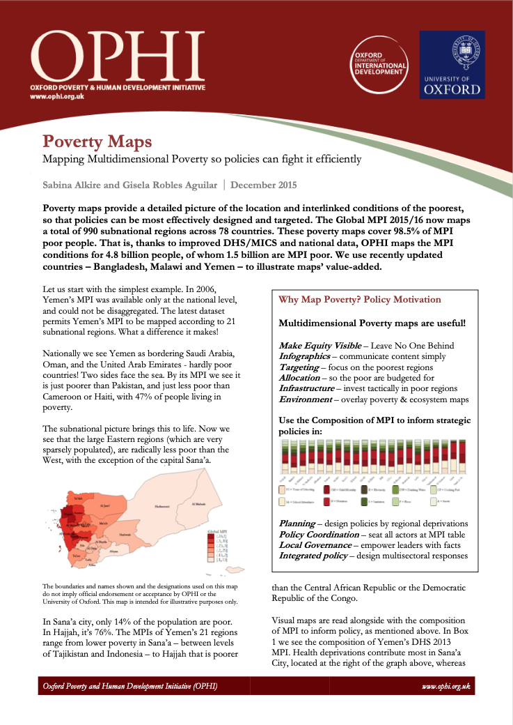
Poverty maps provide a detailed picture of the location and interlinked conditions of the poorest, so that policies can be most effectively designed and targeted. The Global MPI 2015/16 now maps a total of 990 subnational regions across 78 countries. These poverty maps cover 98.5% of MPI poor people. That is, thanks to improved DHS/MICS and national data, OPHI maps the MPI conditions for 4.8 billion people, of whom 1.5 billion are MPI poor. We use recently updated countries – Bangladesh, Malawi and Yemen – to illustrate maps’ value-added.
Citation: Alkire, S. and Robles, G. (2015). 'Poverty maps', OPHI Briefing 37, Oxford Poverty and Human Development Initiative (OPHI), University of Oxford.
Keywords:
poverty policy, global MPI, poverty measurement, multidimensional poverty, Multidimensional Poverty Index
Region:
Global
Poverty Maps: Mapping multidimensional poverty so policies can fight it efficiently
Authors
Sabina Alkire and Gisela Robles
Series Name
OPHI Briefings
Publication date
2015
Publication Number
B 37
Copyright
OPHI CC BY-NC-ND