Maps of vulnerability to COVID-19
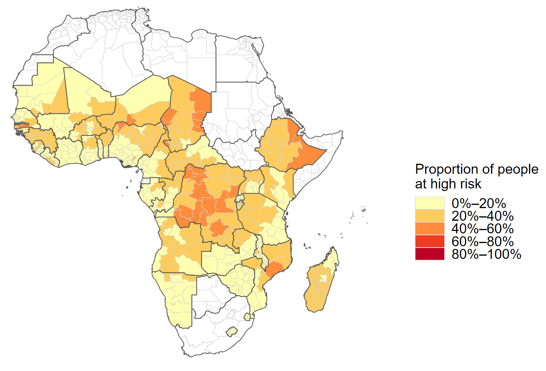
In these maps, OPHI mapped the number and proportion of people that were at high risk to COVID-19 across 40 countries and their subnational regions in sub-Saharan Africa. ‘High risk’ is defined here as the experience of overlapping deprivations in three poverty indicators from the global MPI, namely: nutrition, drinking water and cooking fuel. The maps visualize clusters of high risk that span national boundaries.
The maps used the latest global MPI data as it became available; the datasets were labelled by the relevant year.
Proportion of people at high risk in Sub-Saharan Africa
To identify which areas and regions should be prioritized for interventions, the proportion of people at high risk is a useful metric.
- Map 1a. Proportion of people at high risk (2020 data)
- Map 1. Proportion of people at high risk (2019 data)
Number of people at high risk in sub-Saharan Africa
Another complementary approach to identifying priority interventions is considering the number of people affected.


